The Eye of the Sahara: A Guide to the Richat Structure
From orbit it looks like a perfect bull's-eye in the Sahara. On the ground, the Richat Structure reveals itself differently — through ancient eroded ridges, vast silence, and a geological scale that makes the human presence feel appropriately small.
What the Richat Structure Actually Is
The Richat Structure — known locally as Guelb er Richât and internationally as the Eye of the Sahara — is a 50-kilometre diameter geological feature in the Adrar plateau of western Mauritania. Its concentric ring pattern is distinctive enough from orbit that astronauts aboard the International Space Station use it as a navigation landmark during approaches to West Africa.
For decades after its identification, scientists debated whether the Richat Structure was caused by a meteorite impact — the circular symmetry seemed too precise to be coincidental. Subsequent analysis disproved the impact hypothesis: the structure shows none of the shocked quartz, impact melt, or ejecta expected from a meteorite strike.
The current scientific consensus is geological uplift followed by differential erosion. A section of the Earth's crust domed upward millions of years ago — possibly driven by deep geological intrusion — and then the different rock layers eroded at different rates, exposing concentric rings of increasingly older material toward the center. The structure is estimated to be 500–600 million years old.
What the Ground View Actually Shows
Satellite images of the Richat Structure are famous and dramatic. The experience on the ground is different in character — and fascinating in its own right.
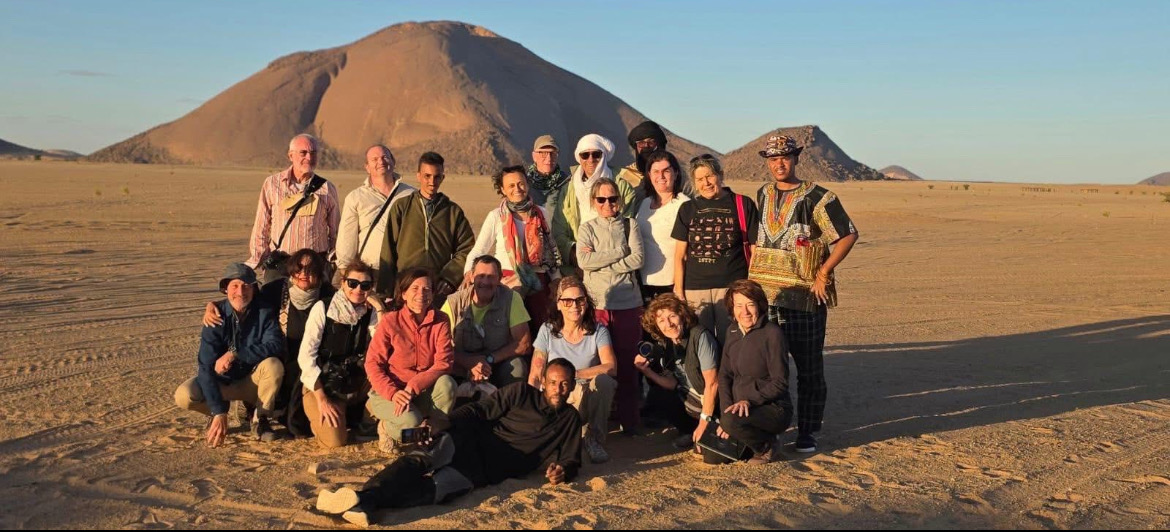
From inside the structure, the bull's-eye pattern is invisible. You stand among ancient quartzite ridges that curve almost imperceptibly, with no vantage point to reveal the geometry below your feet. The concentric ring structure becomes apparent only when you climb to elevated positions on the outer ring walls — from there, the curvature of the ridges ahead hints at the vast shape beneath.
What you experience at ground level is not the pattern but the materials — ancient, beautifully textured rock in colours ranging from deep red to pale grey, wind-sculpted into formations that feel like another planet. The silence is extraordinary. A drone changes the experience entirely: at 150–200 metres of altitude, the concentric ring structure becomes clearly visible, and the photography possible here is of a quality and rarity that almost no other photographers have captured.
The Geology: What You're Actually Looking At
The outermost ring of the Richat Structure is composed of Proterozoic quartzite — among the oldest rock types exposed at the surface anywhere in West Africa. These quartzite ridges are the most resistant rocks in the structure and have eroded most slowly, which is why they form the visible outer walls.
Moving inward, the rings expose progressively different rock formations: sandstones, carbonates, volcanic intrusions including kimberlite (the rock associated with diamond-bearing pipes, though no economically significant diamonds have been found here), and at the center, the oldest exposed rocks in the structure.
The center of the dome also shows evidence of hydrothermal activity — ancient hot spring deposits indicating that geological processes accompanying the dome's uplift involved heat and mineral-bearing fluids moving through the rock. This mineral diversity contributes to the vivid colour variation that makes the structure so visually striking from above.
Getting to the Richat Structure
The Richat Structure lies approximately 40 kilometres west of Ouadane and 130 kilometres northeast of Atar. It is reached from Ouadane by desert piste — the most logical approach for travelers combining it with the ancient city.
The drive from Ouadane to the Richat Structure's outer ring takes 1–2 hours depending on which part of the structure you're approaching. The northern approach gives the best elevated ridge access; the western approach is more direct from the main piste.
There is no road, no signage, no designated parking, and no visitor infrastructure of any kind. This is pure open desert navigation requiring an experienced local guide — not only for finding the way but for knowing which elevated positions give the best views and where it is safe to drive within the structure. Visit our booking page to arrange a guided excursion from Ouadane.
Photography at the Richat Structure
The Richat Structure is one of the finest photography destinations in Africa for landscape and geological work — particularly for drone pilots.
For ground photography: the most rewarding shots come from elevated positions on the outer ring ridges, looking inward across the concentric terrain. Golden hour — the first and last 45 minutes of daylight — transforms the rock colours from grey-red to deep amber. Long shadows at low sun angles reveal texture and layering that harsh midday light completely destroys.
For drone photography: the bull's-eye pattern becomes clearly visible at altitude. Fly at approximately 150–200 metres to see the ring structure clearly while retaining surrounding landscape context. Flying parallel to the ring ridges captures their curvature against the desert. Sunrise is preferable to sunset — the light comes from the east and illuminates the west-facing inner slopes of the rings.
Night photography: the Richat sits in an area of extremely low light pollution. Long-exposure Milky Way photographs with the ancient quartzite ridges as foreground produce images of exceptional quality. Camp overnight with your guide for this.
Combining Richat with Ouadane
The Richat Structure and Ouadane are 40km apart and form a natural 2-day excursion from Atar. The logical approach:
Day 1: Drive from Atar to Ouadane (3–4h). Afternoon in the ancient ksar. Overnight in Ouadane.
Day 2: Morning in Ouadane (mosque, remaining ksar areas). Drive to Richat Structure (1–2h). Half to full day exploring the structure and the most rewarding viewpoints. Camp overnight at the Richat for stargazing and dawn photography, or return to Ouadane.
Day 3: Drive back to Atar via a different piste if your guide knows a good return route. The contrast of ancient human city and ancient geological wonder — both extraordinary, both remote, both essentially beyond mass tourism — makes this combination the most distinctive excursion available in Mauritania.
Frequently Asked Questions
Can you see the Richat Structure pattern from the ground?
Partially, from elevated positions on the outer ring ridges where the curvature of the rings ahead of you is visible. The full bull's-eye pattern only becomes clear from altitude — drone footage is transformative.
Are drones allowed at the Richat Structure?
There is no formal prohibition but also no clear official permission framework for drone use in Mauritania. Consult with your local operator before bringing a drone. In practice, remote geological sites like the Richat are generally undisturbed by authority; sensitivity around people and populated areas matters more.
How far is the Richat Structure from Chinguetti?
From Chinguetti, it's approximately 70-80km to the Richat Structure via Ouadane — a half-day drive on desert piste. The logical routing is Chinguetti→Ouadane (overnight)→Richat Structure→back to Atar.
Plan Your Adventure
Book Your Mauritania Tour
We handle every detail — 4×4 transport with experienced local drivers, the Iron Ore Train boarding at Choum, ancient desert cities, and the guides who open the right doors. Tell us your dates and we'll build the right trip around you.
- Iron Ore Train experience from Choum
- Chinguetti, Ouadane & the Richat Structure
- Terjit Oasis & full Adrar desert circuit
- Banc d'Arguin, Nouadhibou & the Atlantic coast
Keep Reading